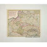
Maps auctions
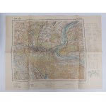
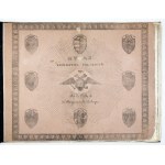
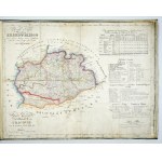
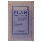
Military Graphic Institutelocal discoloration, soiling, overall dimensions approx. 35.5 x 46.5 cm
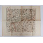
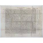
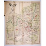
Military Graphic Institutelocal discoloration, soiling, overall dimensions approx. 35.5 x 46 cm
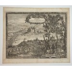
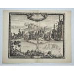
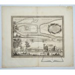
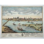
(WARSAW) - "Varsovie, Ville Capitale de la Pologne. Warschau, die Haupt-Stadt in Polen". Copperplate hand-colored in period; G. B. Probst. 18th century (Signed: Georg Balthasar Probst excud. Aug. V.). Dimensions: 30 x 40 cm (board: 32 x 41.5 cm.).Panorama of Warsaw as seen from the other side of the Vistula River. Below the view, explanations of the more important buildings in French and Germa...
Card dimensions: 39.5 x 50 cm. Dimensions of the binding: 56 x 65 cm.
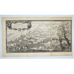
The "Urbs Varsovia" engraving is one of the most spectacular and historically valuable depictions of Warsaw from the mid-17th century. It shows a wide panorama of the city viewed from the Prague bank of the Vistula River, and its composition is based on a sketch made "from nature" on June 22, 1656 by Erik J. Dahlberg - an artist, architect and military engineer, acting in the service of King C...
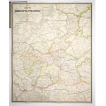
[POLAND - atlas]. KOLBERG Juliusz - Atlas of the Kingdom of Poland. Atlas du Royaume de Pologne. [Warsaw 1826-827; School Lithographic Institute]. folio, maps 8. bound in period psk. (repaired) with preserved pamphlet cover. CKZK 5, 82. Repaired binding: new spine with pasted-on fragments of old leather, new corners, new lining, rubbing of covers. Duplicated maps, three maps with small losses,...
Dimensions: ~92 x 71 cm.
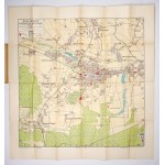
[LVIV]. Lviv plan. Color plan form. 40.8x34.7 on ark. 66.5x96.3 cm. City plan issued before WWI, without publishing data. The plan is divided into sectors (I-VIII, A-E). Much of the sheet is taken up by numerous advertisements of Lviv companies. On the back a map of the Lviv area and information about museums, churches, public buildings in Polish, German and French. Preserved brochure covers. ...
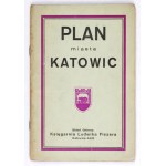
[KATOWICE]. Plan of the city of Greater Katowice and its environs. Color plan form. 54.2x53.8 cm. Plan with index published in Lodz by Księg. L. Fiszer around 1935. Plan was offset printed in Zakł. Graf. K. Miarki in Mikolow. Title in frame in upper left corner, legend there, scale (1:14,000) and city coat of arms. Under the bottom frame, details of the printing house and preparation of the ...
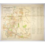
[CHORZÓW]. Königshütte, Oberschlesien. Color plan 48.5x42 on ark. 53x62 cm. Plan prepared by the Städt. Vermessungsamt in Chorzow in 1941. printed in Berliner Lithograph. Inst. Title in box in upper left corner, scale there (1:15,000), linear scale and short legend. In the right margin a list of streets and more important buildings. Verso clean. Folds and edge tears, rubbing at folds.
[BESKIDS]. Touren-Karte für die Beskiden von der Babiagóra bis zum Smrk von Schorr, Kuhn und Schlesinger. The fourth completed edition of Karl Hussak's tourist map of the Beskids, published in Cieszyn in 1911 by the Beskidenverein there. The map was rebound in the lithographic works of Karl Prochaska. Title in box under upper left frame, publishing data and scale (1:150,000) there. In the up...
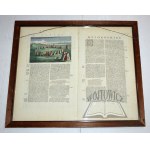
[CALVARY Zebrzydowska]. Mons Calvariae. Copperplate colored engraving form. 32.4x45 cm. View of the sanctuary in Kalwaria Zebrzydowska with the Stations of the Cross taken from Georg Braun and Franz Hogenberg's work "Civitates orbis terrarum", vol. 6, Cologne 1618. Title under the upper frame, slightly to the right. Below, cartouche with dedication to Nicolaus Zebrzydowski, surmounted by figur...
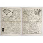
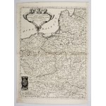
[POLAND]. Polonia Parte Occidentale [and] Polonia Parte Orientale, Descritta, e Dedicata Dal P. Maestro Coronelli Cosmografo [...] All Illustrissimo [...] K. Fedrico Cornaro. Two copperplate engravings form. 60x45.1 on ark. 65.7x47.4 cm each. Imago Pol. K25/1. Two-section map of Poland taken from the 2-volume atlas "Corso Geografico Universale [...] del Vincenzo Coronelli" published in Venice ...
[TATRY]. Tatra Mountains. View from the north. Color panoramic map form. 26.8x78 cm. Panorama drawn by Tadeusz Zwolinski, published in Zakopane in 1936 by the Tourism Promotion League, printed in the National Printing House in Cracow. Covers the area from Spisz to Studena Woda Valley, in the foreground a view of Zakopane. On the back informative text, photographs, schematic map. Traces of fold...
[TATRY]. The High Tatras according to photographs of 1896/97. color lithograph form. 74,3x111,...
88 EUR
[TATRY]. The High Tatras according to photographs from 1896/97. Color lithograph form. 74.3x111.5 cm. Map published by Tatra Society in Cracow in 1903, printed in c. and k. Military Geographical Institute in Vienna. The nomenclature was established by W. E. Radzikowski, W. Kulczynski and S. E. Radzikowski (data under the lower frame on the right). Title in the center above the lower frame, sca...
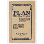
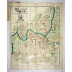
[VILNA]. Plan of the city of Vilnius. Color plan form. 56.6x46.8 cm. First edition of the plan elaborated. by St. Januszewicz, published in Vilnius in 1921 by Ksiazg. J. Zawadzki. Printed in Bydgoszcz in Zakł. Graf. "Bibliot. Pol." Plan with index. Title in frame in upper left corner, scale (1:12,500) and linear scales there. Plan divided into sectors (1-10, A-K). Verso clean. Index: "Index o...
ATLAS von Europa in zwein und achtzig blatterrn von F. W. Streit. Berlin 1837. 4 podł., p. [4], among 82 color maps missing no: 7, 41, 61, 68-71, 79-81, cloth binding contemporary with gilt on spine.Traces of stains and browning of maps. On p. tit. ownership entries.
(Atlas). LELEWEL Joachim - Atlas for ancient history and geography. According to the plan of ... a member of many learned Societies, recommended for use to schools and scientific Institutes: by the Government Commission for Public Enlightenment. Made and published at the School Lithographic Institute in Warsaw 1828. 23.5 x 36 cm, 15 pages in lithography (including title page and 14 line-color ...
[VILNA]. Plan of the city of Vilnius. Color plan form. 56.6x46.8 cm. First edition of the plan elaborated. by St. Januszewicz, published in Vilnius in 1921 by Księg. J. Zawadzki and attached to the index of 1922. Printed in Bydgoszcz in Zakł. Graf. "Bibliot. Pol." Plan with index. Title in frame in upper left corner, scale (1:12,500) and linear scales there. Plan divided into sectors (1-10, ...
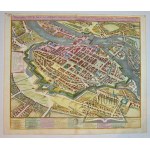
(WROCŁAW). Ichnographica Urbis Wratislaviensis Delineatio, Praeter Alia Exactissime Etiam Repraesentans Singula Templa et Monasteria . . . 1752 Copperplate color. Homann Heredibus. Nuremberg 1752. dimensions: 48.5 x 55.5 cm (board: 51.5 x 61 cm).Carefully executed plan / bird's eye view of Breslau. City streets, buildings, fortifications and surrounding countryside are depicted in great detai...
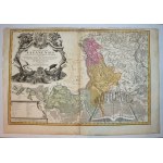
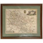
[SILESIA]. Superioris et Inferioris Ducatus Silesiae in suos XVII minores principatus et dominia divisi nova tabula in lucem edita. Colored copperplate form. 48.4x57.7 cm. Map of Lower and Upper Silesia published in Nuremberg by the outhouse of Johann Baptist Homann before 1729. Title cartouche (without the privilege Homann received in 1729) in the lower left corner, in the upper right corner ...
(Dahlberg). (SANDOMIERZ. Swedes and Lithuanians). "Conflictus inter Svecos et Lithuanos dimidio ab Urbe Sandomiria milliari...". J.E. Dahlberg. Nuremberg 1697. copperplate. Board format: 36.5 x 58 cm.Depicts military actions near Sandomierz in the forks of the Vistula and San rivers. On one side the Swedes of Charles Gustav, while on the other side the Lithuanian army led by Pawel Sapieha and ...
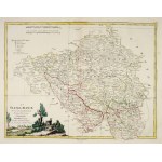
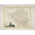
[SILESIA]. La Slesia Super-e divisa ne suoi proncipati. Di nuova Projezione. Copperplate colored engraving form. 31.3x40.6 cm. Map of Upper Silesia taken from "Atlante novissimo illustrato" (Venice 1779-1782, published by Antonio Zatta). Title in the lower left corner, date 1779 there. Under the upper frame on the left two linear scales and a legend. Above the upper frame on the right, number ...
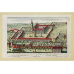
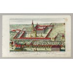
[HENRICHS]. Prospectus Henrichovy Coenoby Sacr. ac Exemt. Ordinis Cisterciensis, in Silesia superiore. Prospect des Stüffts Heinrichau, Cistercienser-ordinis in Ober-Schlesien. Colored copperplate form. 16.8x28.6 cm. Cistercian monastery in Henryków from a bird's eye view on a copperplate engraving by Johann Georg Merz based on a drawing by Friedrich Bernard Werner, published in Augsburg aro...
[ZAKOPANE]. Zakopane. Color plan form. 35.3x47.2 cm. Plan of Zakopane with panorama of the Tatra Mountains, published in 1940 by Gebethner and Wolff, printed at Z.W.K. Krakau works. Title in lower left corner, wind rose and linear scale there. Bilingual legend in the lower right corner. Traces of folding, taped small tears at folds, stains on back. .
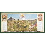
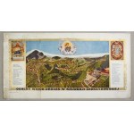
[KALWARIA Zebrzydowska]. General view of the paths in Kalwaria Zebrzydowska. Color print form. 19.5x44.5 on ark. 24.7x48.5 cm. Panorama of the Kalwaria sanctuary, probably published in the 1930s by Jozef Cebulski in Cracow. Title on the lower frame, in the upper corners a figure depicting the Third Fall of Christ and the frame of the Virgin Mary from the main altar. On both sides of the panora...
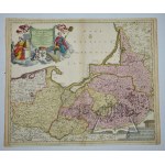
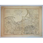
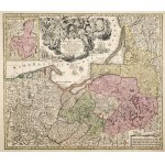
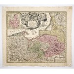
[PRUSY]. Borussiae Regnum sub fortissimo Tutamine et juristissimo Regimine [...] Friderici Wilhelmi [...] cum adjacentib. Regionibus mappa Geographica delineatum. Copperplate colored engraving form. 48.8x56.7 cm. Krassowski 131. first edition of the map of Prussia by Matthäus Georg Seutter published in Augsburg in 1725-1728. It was published as a self-contained map, and was also included in a...
[EXCLUSIVE]. Karte des Gebietes der Freien Stadt Danzig (1 cm-Karte). Map form. 68.8x87.7 on ark. 79.4x98.3 cm. Map of the distant environs of Danzig, prepared in Berlin by the Reichsamt für Landesaufname and published there in 1930. Title on the background of the Baltic Sea. In the right margin an elaborate legend. In the lower margin publishing data, linear scale and scale (1:100,000). Cove...
(WWII escape map). Central Europe. Scale 1:2,000,000. Dimensions: 51.5 x 47.5 cm.Condition b. good. The map was owned by Antoni Tomiczek (1915-2013), who was a Polish military pilot and World War II veteran, known primarily for his airdrop flights over occupied Poland, including over Warsaw during the 1944 uprising. After the war, he returned to his homeland and lived in Silesia, and his heroi...
(POZNAŃ). Plan of the capital city of Poznan. Poznan b.r. Nakł. Bookstore Wydawnicza Spółdz. "Pomoc. Color map, folding, size 52 x 67 cm.Very good condition.
(Dahlberg). (ZAWICHOST). "Prospectus Oppidi Savichost...". J.E. Dahlberg. Nuremberg 1696. copperplate. Format: 29 x 38 cm, (board: 35 x 42 cm). Signed "E. I. Dahlberg. Supr: Castr: metat: delin.".Rakoczy with his troops forcing the Vistula River near Zawichost. Expanded landscape and compact groups of troops crossing the Vistula at the ford. Engraving from the work of Samuel Pufendorf. Traces ...
[SILESIA]. La Slesia Infer-e divisa ne suoi proncipati. Di nuova Projezione. Copperplate colored engraving form. 32.8x42.8 cm. Map of Upper Silesia taken from "Atlante novissimo illustrato" (Venice 1779-1782, published by Antonio Zatta). Title in upper right corner, date 1779 there. Under the upper frame in the center two linear scales and legend. Above the upper frame on the right No. VIII. U...
(Dahlberg). (GDAŃSK). Dantiscum. J.E. Dahlberg. Nuremberg 1697. bipartite copperplate. Signed "De La pointe sculp." Board format: 36.5 x 41 cm.In the upper part a perspective view of the city. Bottom bird's-eye view, topography of suburbs and surroundings with Vistula estuary and fortress. Between city panorama and plan, legend with list of 30 important monuments of the city. Good condition. ...
(GALICIA). "Carte de la Pologne Autrichienne contenant La Russie Rouge et la partie meridionale du Palatinat de Cracovie, etc.". Copperplate. color. linear. Drefsee sur l'Exemplaire des Heritiers Homan 1775. a Venise par P. Santini 1776. chez M. Remondini. (Venice 1776). Format: 44.5 x 59 cm (board: 52 x 75.5 cm).Traces of dampstain. good condition. Title in decorative cartouche in lower left ...
[POLAND]. Mappa of the Kingdom of Poland with distance markings on iron, beaten and ordinary roads laid out and lithographed by Marceli Gotz. Colored lithograph form. 70x57 cm. Szaniawska II 118. Overview map of the Kingdom of Poland arranged and lithographed by Marceli Gotz, published in Warsaw by Gebethner & Wolff in 1881. Title in a frame in the upper left corner, below it a legend in a...
(northern POLAND). "Ducatus Prussiae tam Polono Regiae...". Copperplate color. Justus Danckerts. Amsterdam ca. 1696. Format: 49.3 x 58.5 (board: 51 x 61.5 cm).Good condition. Map included in Cornelius Danckerts' atlas at the end of the 17th century, and compiled by Justus Danckerts. Richly decorated information cartouche with the coat of arms of Prussia in the upper left corner; scale in the l...
(LITHUANIA, Belarus). "Vilkomierz, Dvinsk, Vilna, Vileyka, Slonim, Minsk. Generalstabes der Armee. (Berlin) 1916. scale: 1:300,000. dimensions: 123 x 93 cm.Folding map of large size with extremely rich topographical nomenclature. Good condition.
(POLAND). "Carte de l'ancien Royaume de Pologne : partagé entre la Russie, la Prusse l'Autriche".
516 EUR
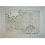
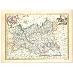
(POLAND). "Carte de l'ancien Royaume de Pologne : partagé entre la Russie, la Prusse l'Autriche". Par les traités successiss de 1772, 1793, et 1795 : contenant aussi, le Royaume de Prusse / par E. Mentelle, Membre de l'Institut Nationale et P.G. Chanlaire, l'un des Auteurs de l'Atlas National.Line-colored copperplate. Mentelle, Edme (1730-1815) Author, publisher. Chanlaire, Pierre-Gilles (17...
(Dahlberg). (ZŁOTÓW and Drawsko Stare). "Flatou Pomerelliae Arx dificillimi accessus...". J. E. Dahlberg. Nuremberg 1697. copperplate. Format: 36.5 x 41 cm. Depicts at the top the castle of Zloty fired by the Swedes. At the bottom a projection of Drawsko castle among the waters of the lake. Engraving from the work of Samuel Pufendorf. Good condition. A strong print. Unw. traces of yellowing ...
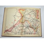
Postal and communications ATLAS of the Rzpl. Poland. Warsaw b.r. Nakł. Inst. Kartograficzny "Gea". 8, p. [2], 1 map - (Skorowidz...), XXI color folding maps. and:- Supplement to the map and postal-communication atlas in the scale 1:800,000. n.d. Warsaw. Nakł. Tow. Kartog.-Wyd. "Gea". 8, pp. 102, [2], publisher's fawn binding.Unwarranted rubbing and dustiness of binding. Good condition. The a...
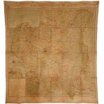
Military Geographical Institute, Warsaw, 1934 Edition B, reference edition Scale 1:1000000 Color print, paper glued on canvas; 102.5 x 94 cm Condition: traces of flooding, rubbing on folds Asking price 400 Estimate 500 - 600 ask about the object
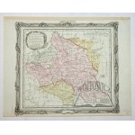
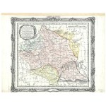
[POLAND]. Le Royaume de Pologne, divisé selon les Partages faits en 1772, 1793 et 1795, entre la Russie, la Prusse et l'Autriche. Colorized copperplate form. 47.7x53.6 cm. Imago Pol. K47/4. Map of Poland (third state) by Gilles and Didier Robert de Vaugonda with the borders of the three partitions marked, published in Paris after 1795 by Hyacinthe Langlois. Title in upper left corner, in a ca...
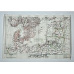
(WWII escape MAP). Northern Europe (Baltic Sea basin). "Scandinavia and The Baltic (lower half)". Scale 1:3,000,000. dimensions: 36 x 56 cm.Condition b. good. The map was owned by Antoni Tomiczek (1915-2013), who was a Polish military pilot and World War II veteran, known primarily for his airdrop flights over occupied Poland, including over Warsaw during the 1944 uprising. After the war, he r...
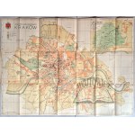
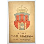
(KRAKOW). New Plan of the City of Cracow Plan of the Wolski Forest - Directory of streets - Information section. Cracow (b. r.) Publisher of the Salon of Polish Painters. Druk "Akropol". 8, p. [4], plan size: 54.2 x 74 cm. Plan in color, prepared by Adam Launer. Condition of the plan good, soiling and non. rubbing of the cover.
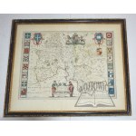
(OXFORDSHIRE). Oxonium Comitatus, vulgo Oxford Shire. Copperplate color. Amsterdam ca. 1645; Joan Blaeu. Dimensions in light frame: 48 x 58 cm, (in frame behind glass: 54.5 x 64.5 cm).Two-page map of the county of Oxford on the Thames. Extremely decorative map with figural title cartouche (two scholars). Royal coat of arms and sixteen other college coats of arms along both sides of the map. Th...
DIMENSIONS: 110 X 210 MMNUMBER OF PAGES: 80
(POLAND, Duchy of Warsaw). G(rand) Duche de Varsovie; Prusse. Color copperplate. At bottom signed Grave par Chamouin (engraver); Ecrit par Aubert (author) fils. (Paris ca. 1812). Format: 21.8 x 29.8 cm (board: 25.5 x 33.5 cm)Good condition. In upper right corner a Polish lancer on horseback with a banner. The Duchy of Warsaw existed between 1807 and 1815, so the map is a testimony to the geopo...
(ŻAGAŃ). "Principatus Silesiae Saganensis in suos circulos Sagan Priebus et Naumburg divisi et ...".
282 EUR
(ŻAGAŃ). "Principatus Silesiae Saganensis in suos circulos Sagan Priebus et Naumburg divisi et ...". Color copperplate. 1736. comes from the atlas: Homannianis Heredibus - Atlas Silesiae .... Nürnberggae 1752. according to Schubarth and Wieland. Format: 62.5 x 91 cm. Traces of dampstaining and browning, edges slightly creased with some tears, fold marks. A large information cartouche in the...
MAP OF CENTRAL EUROPEWoodcut, paper, 31 x 36.5 cm (illus p-p) Landtafel des Ungerlands/Polands/Reussen/Littaw/Walachey und Bulgarey From "Cosmographia", published by Sebastian Henricpetri, Basel 1588; Imago Poloniae K6/11 Asking price 1200 Estimate 1500 - 1800 inquire about the object
(POLAND). "The Kingdom of Prussia and its newly incorporated Province of Polish Prussia now named Western Prussia, with the territory of Dantzick by John Roberts. London 1794. published by Laurie & Whittle. Copperplate, line-colored. Dimensions: 46.5 x 62.5 cm (board: 54 x 73 cm).Good condition. The map was published in atlases: Laurie & Whittle: General atlas (London 1795); New univer...
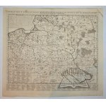
(POLAND). "Nouvelle carte du Royaume de Pologne, divisee selon ses palatinats et ses provinces, ...". Copperplate. The map comes from H. A. Chatelain - "Atlas historique...", T. 1 - 4, was published between 1705 and 1739 in Amsterdam and Paris. Format: 50 x 57,7 cm (board: 56 x 63,5 cm). Good condition. Title lettered above the upper frame of the map. Map compiled by Amsterdam publisher and ge...
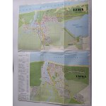
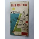
SZCZECIN, PLAN OF SZCZECIN, PAŃSTWOWE PRZEDSIEBIORSTWO WYDAWNICTW KARTOGRAFICZNYCH WARSAW 1969
5 EUR
DIMENSIONS 600 X 660 MM
(POLAND). "Estats de Pologne et de Lithuanie...". Copperplate color. Derived from: Brion M.- Atlas Général, Civil, Ecclésiastique et Militaire...". Paris 1786. Dimensions: 27.5 x 30.5 cm (board: 29.5 x 37.5 cm).Author: Louis Brion de la Tour - French geographer and demographer, bearing the title Ingénieur-Géographe du Roi (engineer-geographer of the King of France). He depicts the territo...
(POLAND). "Carte de la Pologne, ou sont indiquees Les parties echues l'Auriche, a la Russie, parles partages de 1772, 1793, 1795, &c.". Copperplate, line-colored. Par Nolin. Revue et augmentee 1831. a Paris chez Jean de Beauvais. Dimensions: 49 x 64 cm. The name Nolin refers to a Parisian family of cartographers and publishers active from the late 17th to the 19th century. Text information...
Historical atlas for ancient, medieval and modern history for the use of the higher and secondary scientific establishments of Austria-Hungary. Published by Alfred Baldamus and Ernest Schwabe. Contains 52 large and 61 smaller maps. Polish edition compiled by. J. Lewicki and Wł. Bojarski. 2nd ed. Vienna 1908. ed. by Nakł. A Pilcher's Widow and Son. 8 (large), pp. X, color maps. 32, cloth bind...
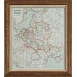
THE POLISH REPUBLIC OF THE XVII CENTURYPrinted by the author, lith. by Karol Kranikowski, Cracow color lithograph, paper; 51.5 x 44 cm Condition: traces of folding Bound Asking price 300 Estimate 400 - 500 ask about object
(Dahlberg). (WYECIE near Danzig). "Ichonographia Castri Schwetz". J. E. Dahlberg. Nuremberg 1696. bipartite copperplate. Format: 26 x 31.5 cm. Depicts a plan and view of a castle occupied by the Swedes. The castle on a river island flanked, by the waters of the Vistula and Wda rivers. Engraving from the work of Samuel Pufendorf. Good condition.
Chromolithography, paper pasted on canvas; 81 x 124 cm (16 sheets) Condition: stains, discoloration of paper Asking price 450 Estimate 800 - 1000 ask for object
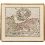
Ducatus Pomeraniae novissima tabula in anteriorem et interiorem divisa.... Copperplate colored in watercolor, paper, 50.5 x 59.5 cm (illus. p-p) Condition: paper creases Asking price 800 Estimate 1800 - 2000 ask for object
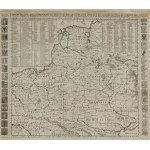
avec la chronologie des rois et des ducs de Lithuanie ainsi que des grands maitres de l'ordre Published by Henri and Zacharias Châtelain, Amsterdam 1714 Copperplate, paper; colored, 53 x 61 cm (illus p-p) Imago Poloniae K30/5 Asking price 1500 Estimate 1800 - 2000 ask for object
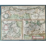
Copperplate colored in watercolor, paper; 38 x 49.5 cm (illus. p-p)From: Theatrum orbis terrarum , Antwerp, ca. 1700Pomeraniae, Wandalicae Regionis, Typ.; Livoniae Nova Descriptio, Joanne Portantio auctore; Ducatus Oswieczensis, et Zatoriensis, DescriptioAsking price 900Estimate 1800 - 2000 inquire about the object
(POLAND). Nieuwe kaart vant' Koninkryk Poolen verdeelt in zyn byzondere Waywoodschappen; na de Nieuwste stelling int' ligt gebragt: te Amsterdam door Izaak Tirion. Copperplate color. Engraver: Jacob Keyser; Publisher: Isaac Tirion. (Amsterdam after 1733). Format: 28.7 x 34.5 cm (board: 38 x 49 cm). Good condition. Informational cartouche in upper left corner. At the bottom right between the fr...
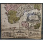
Copperplate colored watercolor, paper; 49 x 57.5 cm (illus p-p)Accurata Designatio Celebris Freti prope Andalusiae Castellum Gibralter inter in Europam et Africam cum circumjacentibus Portubus et Castellis cura et impensis Asking price 900Estimate 1800 - 2000 inquire about the object


![[LVIV]. Lviv plan. Color plan from before the First War](https://img1.one.bid/img/8698/2897303_1w.jpg)
![[LVIV]. Lviv plan. Color plan from before the First War](https://img1.one.bid/img/8698/2897303_2w.jpg)
![[BESKIDS]. Touren-Karte für die Beskiden von der Babiagóra bis zum Smrk von Schorr,...](https://img1.one.bid/img/8698/2897283_1w.jpg)
![[CALVARY Zebrzydowska]. Mons Calvariae. Copperplate colored engraving from 1618](https://img1.one.bid/img/8698/2897294_1w.jpg)
![[CALVARY Zebrzydowska]. Mons Calvariae. Copperplate colored engraving from 1618](https://img1.one.bid/img/8698/2897294_2w.jpg)
![[TATRY]. Tatra Mountains. View from the north. Panorama from 1936](https://img1.one.bid/img/8698/2897305_1w.jpg)
![[TATRY]. The High Tatras according to photographs of 1896/97. color lithograph form. 74,3x111,...](https://img1.one.bid/img/8698/2897288_1w.jpg)


![[SILESIA]. Superioris et Inferioris Ducatus Silesiae. Before 1729.](https://img1.one.bid/img/8698/2897285_1w.jpg)
![[SILESIA]. Superioris et Inferioris Ducatus Silesiae. Before 1729.](https://img1.one.bid/img/8698/2897285_2w.jpg)
![[ZAKOPANE]. Zakopane. Color plan from 1940](https://img1.one.bid/img/8698/2897310_1w.jpg)
![[EXCLUSIVE]. Karte des Gebietes der Freien Stadt Danzig . 1930.](https://img1.one.bid/img/8698/2897289_1w.jpg)
